Portfolio
- All
- GIS
- Python
- R
- Web Development
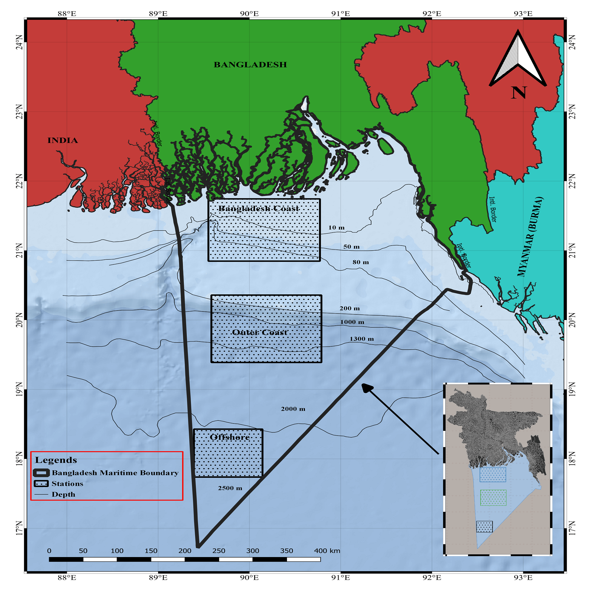
Chlorophyll-a Distribution Map
Tools: SeaDAS, ArcGIS Pro
Satellite-derived chlorophyll-a concentration mapping in the Bay of Bengal for marine productivity assessment.
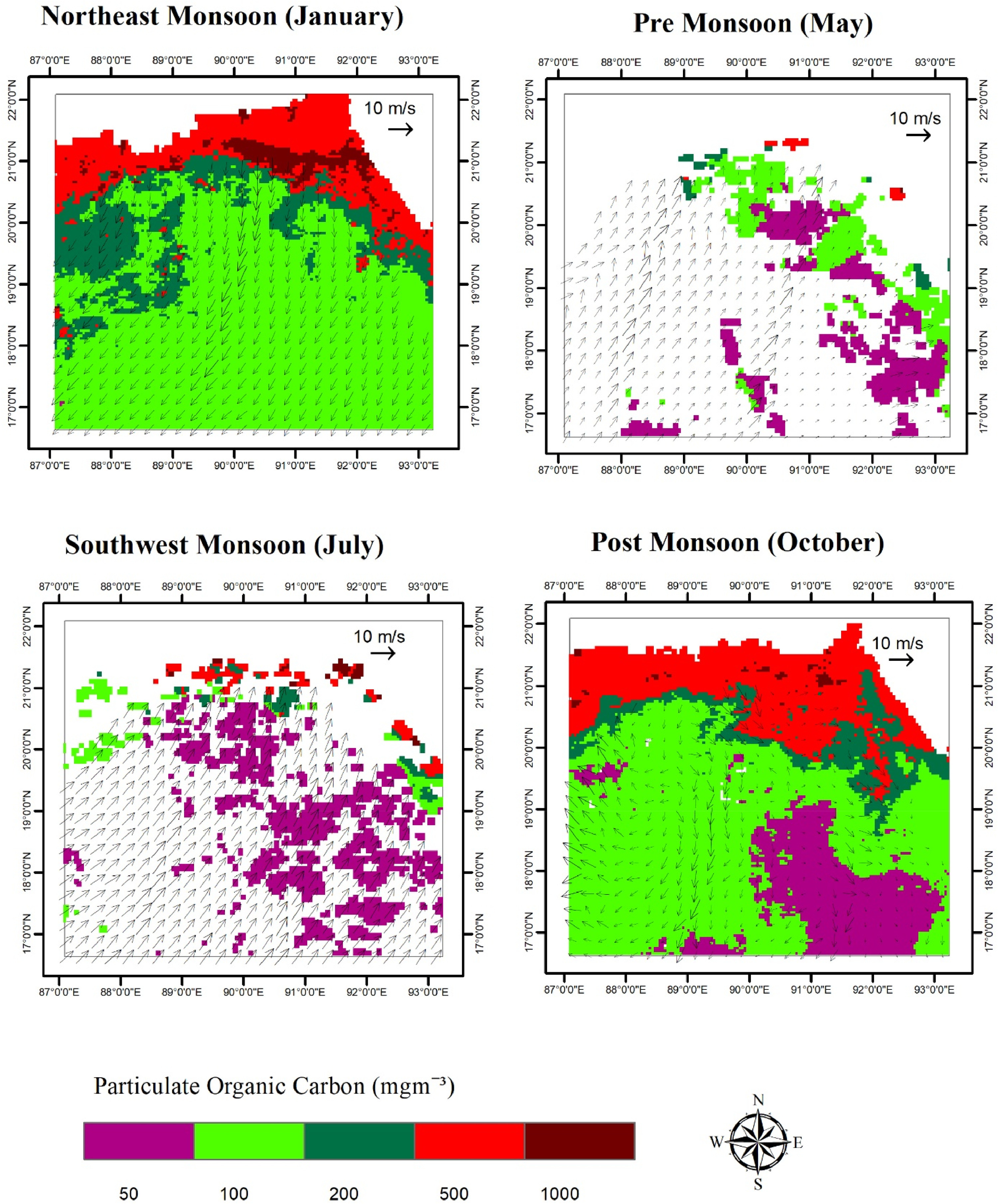
Wind Speed Field Visualization
Tools: ArcGIS Pro, Python
Spatial analysis of wind speed patterns over Bangladesh maritime boundary for oceanographic studies.
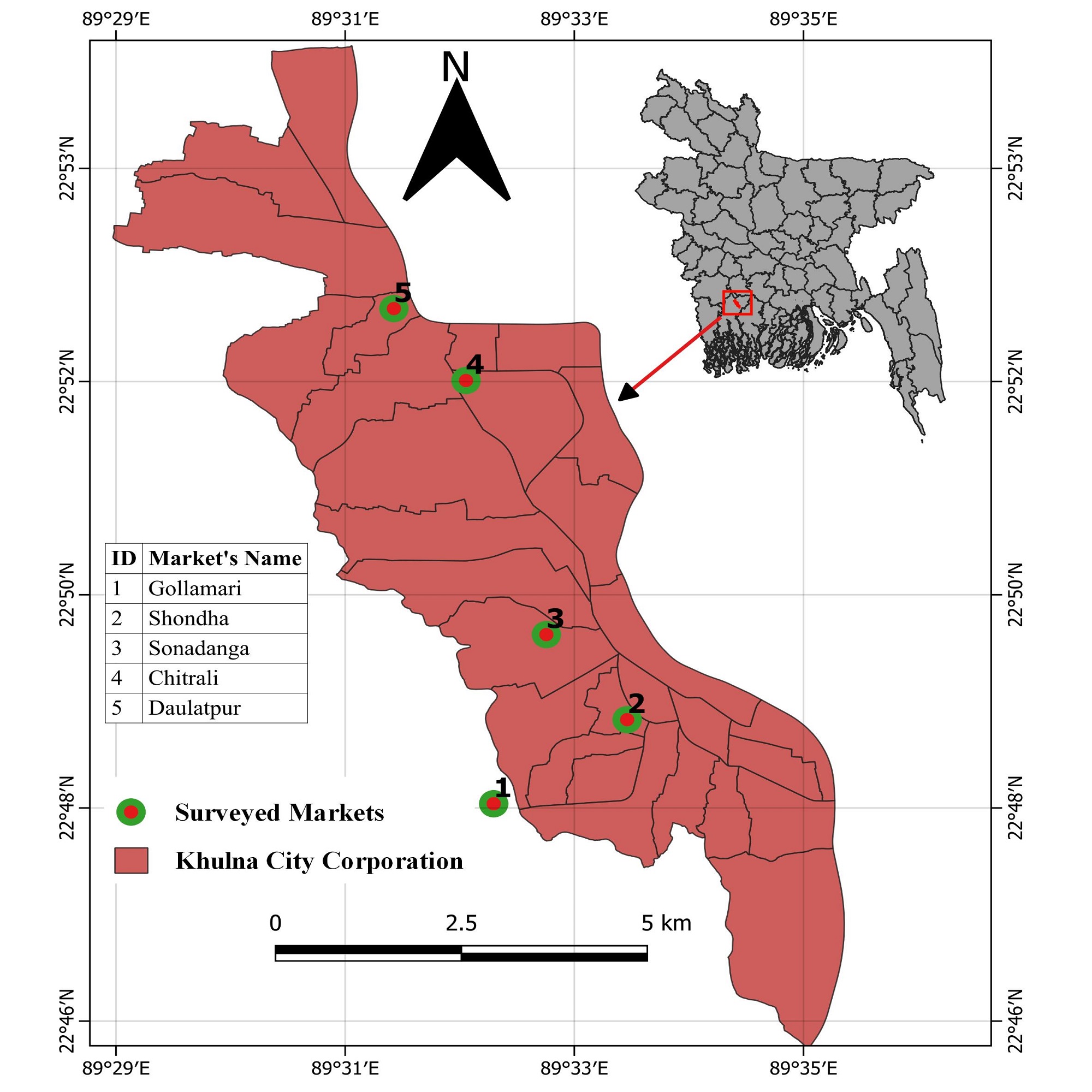
Land Use/Land Cover Change Analysis
Tools: ArcGIS Pro, Remote Sensing, QGIS
Temporal analysis of LULC changes in Khulna region using multi-temporal satellite imagery.
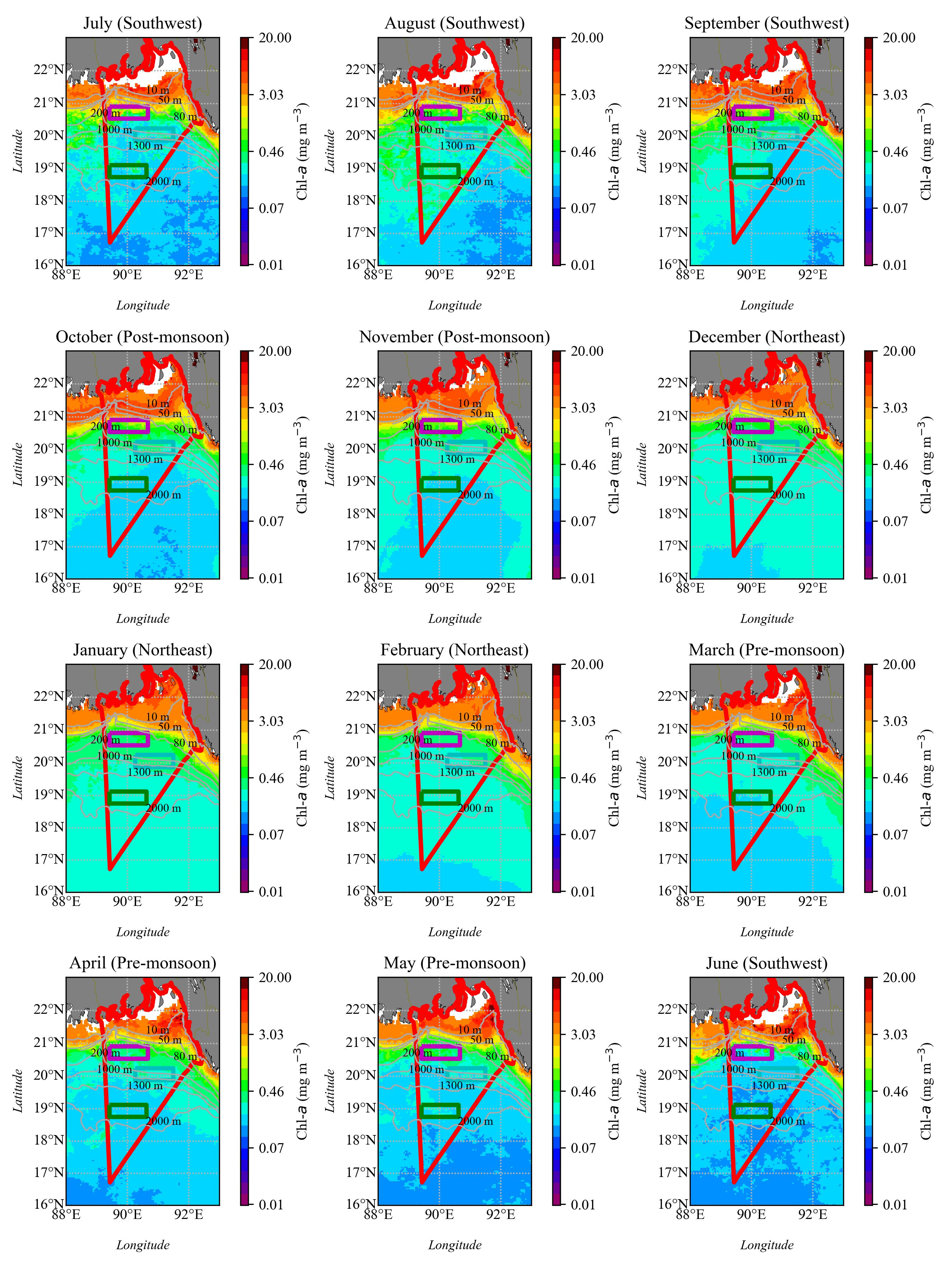
Composite Chlorophyll-a Imagery
Tools: Python, SeaDAS, MODIS
Multi-temporal composite of satellite chlorophyll-a data for marine ecosystem analysis in Bay of Bengal.
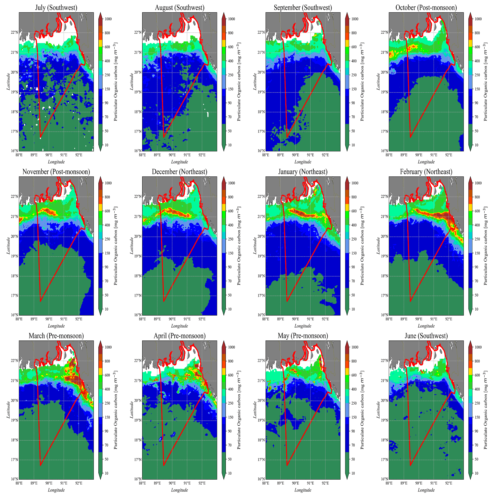
Monthly Ocean Parameters Analysis
Tools: Python, R, SeaDAS | Year: 2021
Monthly variability analysis of POC, SST, and Chl-a. Published in Regional Studies in Marine Science.
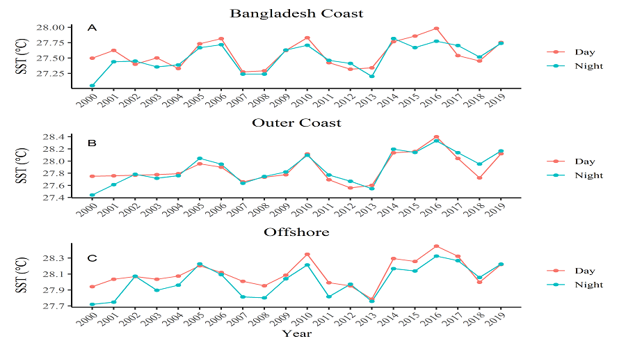
Sea Surface Temperature Time-Series
Tools: R, ggplot2, MODIS Data
Yearly SST trends with diurnal variability analysis using statistical visualization techniques.
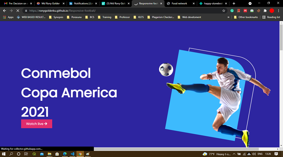
Responsive Sports Website
Tools: HTML5, CSS3, Bootstrap, JavaScript
Fully responsive football website demonstrating modern web development practices and mobile-first design.